
The boat dock at Grandpappy Point Marina (May 24, 2015). ⇑
Record Breaking Rains
North Texas has been receiving higher than normal levels of rain for the last few months. In fact, this is the 3rd wettest May on record with 21 out of 27 days bringing rain for a total of 12.31 inches of rainfall. Most area lakes are at or above flood levels. Update: As of 5:00 PM, May 29, 2015 North Texas has now received 16.07 inches of rain during the month of May — with more expected tonight. This breaks the 1982 record of 13.66 inches and sets May 2015 as the 3rd wettest month ever. In fact, 2015 stands as the 2nd wettest year ever with 30.74 inches of rain so far.
Lake Texoma
For only the 4th time in 58 years, water began flowing over the Lake Texoma spillway May 24, 2015. The lake level must be 640 feet above sea level in order for water to flow over the dam. You can view videos about this historic occurrence here and here. One TV reporter said that the water was spilling over at rate equal to 3 olympic size pools every 3 seconds (I’m still looking for documentation of this as fact; but it does provide a good visual).
Crowds Travel to View Historic Lake Level
Along with many other people, we drove out to the lake over the weekend to see the high water levels. There was plenty of traffic flowing around the lake. North Texas e-news published an article about the weekend crowds. You can read it here.
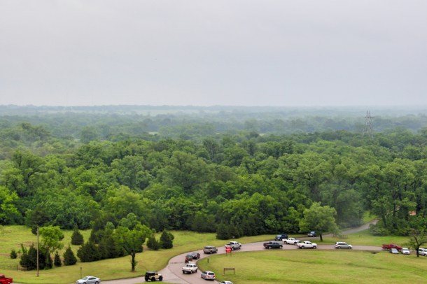
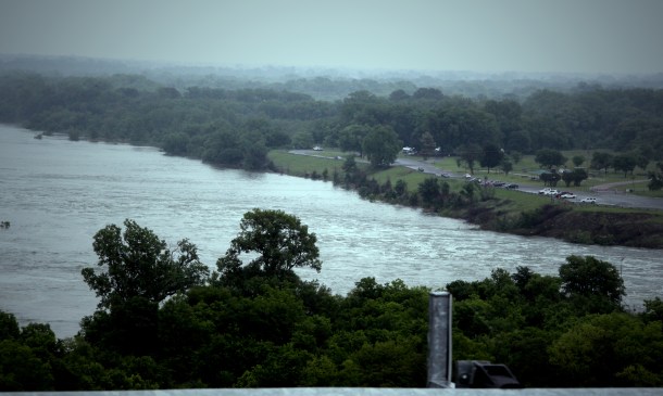
The roads around the lake were busy as people tried to get close to the lake. ⇑
Water Flowing to the Red River
Saturday May 23, 2015, the lake was reported to be 17 feet over the “full pool” level and about a foot from going over the spillway. Full pool level is the elevation of the lake at maximum flood control storage.

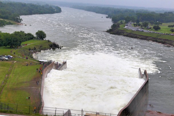
Water was being released through the hydropower generators and three flood conduits. ⇑
The Red River is Full
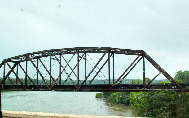


The Red River was full and flowing heavily. It was almost dry the week before. ⇑
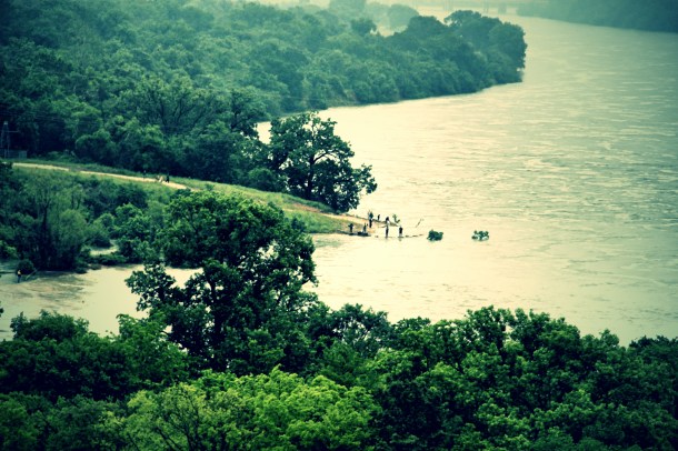
Grandpappy Point

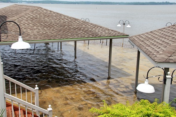
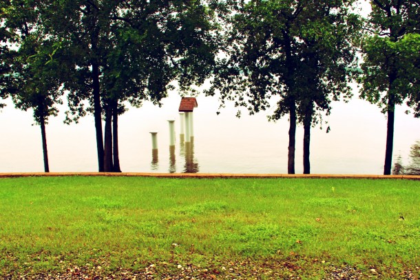
Water was high at one of our favorite camping and fishing areas near Grandpappy Point Marina. ⇑
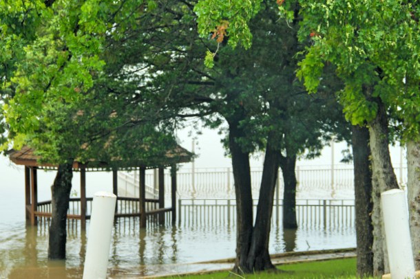
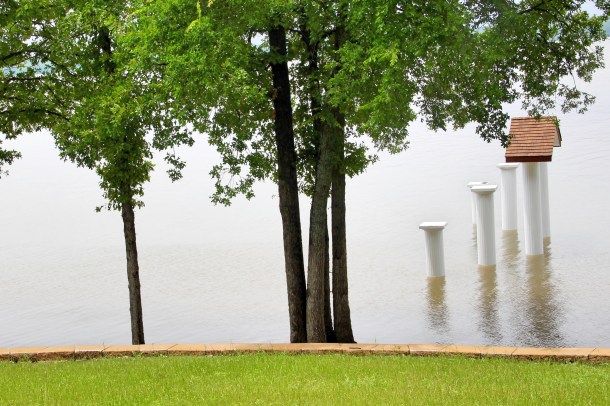
Lake Texoma and Flooded Campgrounds
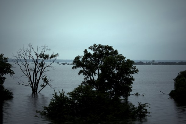


Photos of the lake and some of the campgrounds that were already underwater. ⇑
Lake Texoma is one of the largest water reservoirs in the United States. The lake spans the border between Texas and Oklahoma — in the area east of I-35 and west of I-75. Lake Texoma covers 78,420 acres and 2,516,232 is aptly named after Texas and Oklahoma.
Here are a few facts about the lake from the Hand Book of Texas:
- The dam is an earth embankment of rolled-fill type, 15,350 feet long and 165 feet high.
- It was built for flood control, power generation, conservation, and recreation.
- The lake and dam have 1,250 miles of shoreline and protect 1,127,000 acres of land.
- Recreational facilities in the 194,775-square-mile area are under direction of the National Park Service, which maintains concessions for hunting, boating, fishing, and camping.
- Lake Texoma covers 78,420 acres and has a capacity of 2,516,232 acres-foot. (An acre-foot is the amount of water necessary to cover an acre with water one foot deep. — Texas Almanac)Have you ever witnessed a similar historic event?


Someone informed me yesterday that the year before the Dust Bowl drought hit, this area received 33 inches of rain. Hope this is not a repeat.
LikeLike
Hmm! Let’s hope not!
LikeLike
Lots of water
LikeLiked by 1 person
Yes it is! I’m hoping to get to some photos of the water over the spillway. I’ve got a sick little guy to take care of; so, I might not make it.
LikeLiked by 1 person
Hope he gets better soon
LikeLiked by 1 person
Thanks. He’s went to the doctor today. Things should get better. 🙂
LikeLiked by 1 person